Galerie
-
-
Photo, © leblogcashpistache
Une équipe prête à organiser votre séjour en Pays de Langres
Un conseil sur votre séjour ?

Des conseillers en séjours touristiques
A votre service pour faire de votre séjours un agréable moment de découverte et de détente !
Services
Derrière ses remparts, le parfum de l’histoire
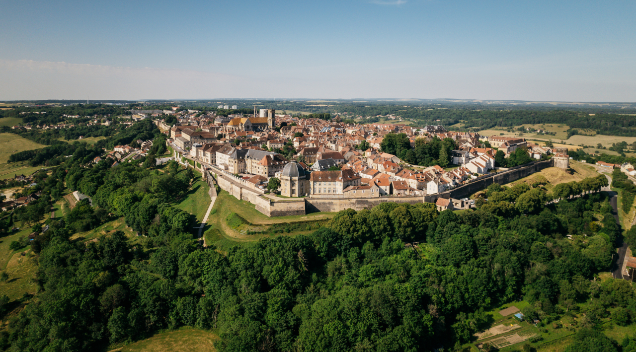
Depuis son acropole défendue par de puissants remparts, Langres jouit d’une position dominante. Peuplée par les Gaulois, elle a traversé les siècles et conserve de l’époque gallo-romaine jusqu’à aujourd’hui d’innombrables trésors architecturaux et artistiques.
Prenez le temps de visiter cette ville d’art et d’histoire qui vit grandir Denis Diderot et Jeanne Mance. De nombreuses idées de séjour vous y invitent. Découvrez le panorama grandiose depuis son chemin de ronde, sentez l’atmosphère des ruelles au pied de sa cathédrale, venez assister à l’un des grands événements de la saison culturelle.
Pour tirer le meilleur de votre séjour, aidez-vous de notre sélection d’hébergements et de bonnes tables. En famille ou en amoureux, la cité perchée vous souhaite la bienvenue.
Galerie

Ville d’art et d’histoire


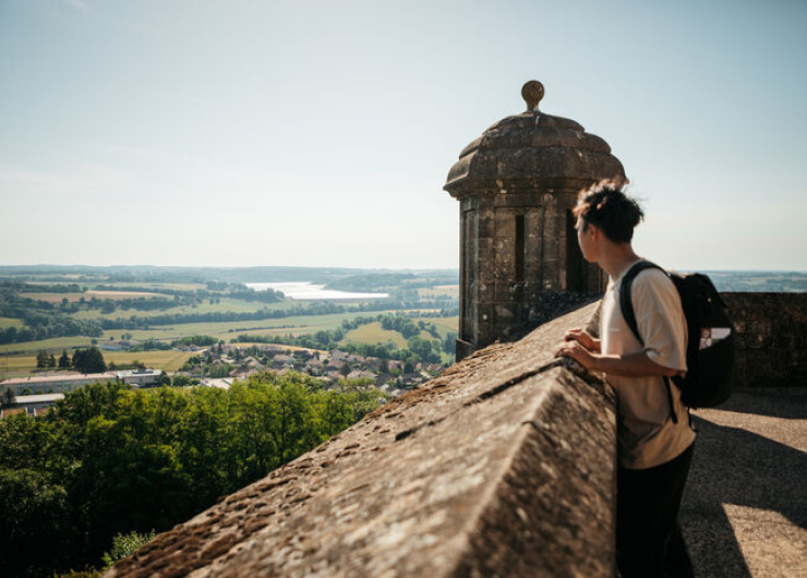
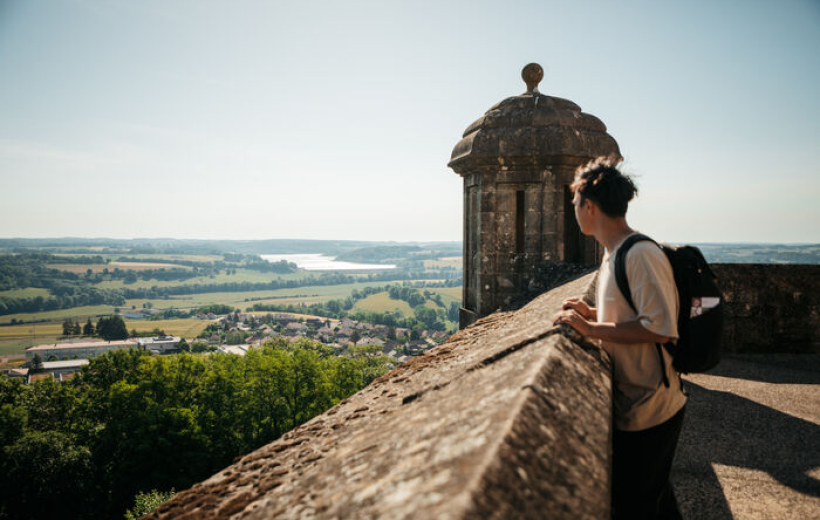
À l’abri de ses remparts, Langres vous réserve une plongée au cœur de l’histoire. Suivez les clous dorés du circuit “pas à pas”, ils vous guideront lors de votre visite. Imaginez la vie sous l’époque gallo-romaine grâce aux très riches collections du Musée d’Art et d’Histoire. Empruntez le chemin de ronde et admirez les ouvrages défensifs, portes, tours, bastions…

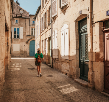
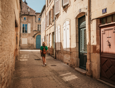
Perdez-vous dans le dédale de ruelles de la vieille ville jusqu’à la cathédrale Saint-Mammès. Vous croiserez des trésors d’architecture Renaissance.
À la Maison des Lumières, plongez au cœur du XVIIIème siècle et admirez un exemplaire original de l’Encyclopédie.
Peut-être sentirez-vous encore l’esprit de Diderot, natif de Langres, planer sur la cité perchée ?

Pour un week-end en amoureux ou un séjour en famille, venez respirer le bon air de la cité perchée et du plateau de Langres.
Parmi le champ des possibles :


Elles sont la signature visuelle de la ville

Adaptées, restaurées, agrandies et conservées au fil des siècles, les fortifications de Langres forment “la plus grande enceinte fortifiée d’Europe ».
8 km de remparts relient la vieille ville et la citadelle du XIXème siècle pour faire de Langres une « forteresse à 2 têtes ».
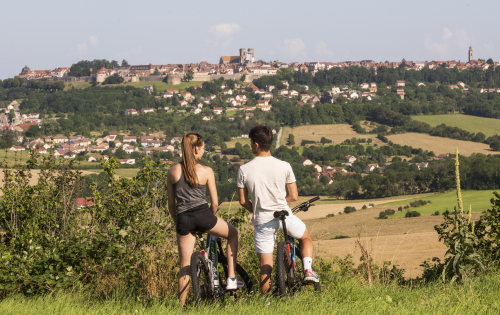
Depuis les hauteurs du chemin de ronde, respirez l’air du large. Des points de vue grandioses sur les forêts du plateau de Langres, le lac de la Liez et les massifs lointains s’offrent à vous.


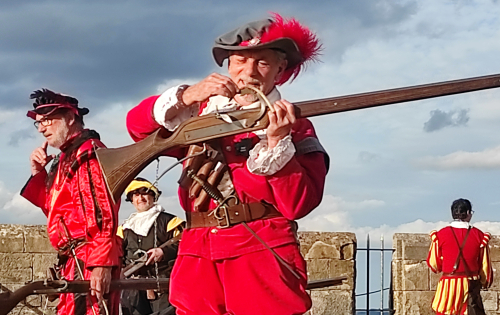
Ville d’art et d’histoire, Langres vous invite à vivre l’année au rythme de ses grands événements.


Déposez vos bagages en Pays de Langres pour une étape ou un séjour.
Auberge de campagne ou hôtel de charme, choisissez selon vos désirs.
Optez pour l’atmosphère d’un ancien prieuré à l’hôtel du Cheval Blanc ou pour un séjour au bord de l’eau à l’hôtel des Voiliers et profitez des talents de leurs chefs de cuisine.
Partisan du charme d’une chambre d’hôte ? Le belvédère des remparts, son jardin et sa vue sauront vous séduire. Autonome et citadin, plusieurs gîtes vous accueillent en plein centre-ville.
Pèlerins et marcheurs, vous trouverez respectivement un presbytère où vous abriter et un camping en plein cœur de la ville historique.

Bien sûr, le fromage de Langres AOP est l’ambassadeur gastronomique de notre terroir. Mais entre Champagne et Bourgogne, le label “Made in Pays de Langres” distingue aussi une large palette de saveurs, de la truffe aux escargots, du miel aux bons produits de la ferme.
Grâce à une nature préservée et des producteurs rigoureux, vous trouverez dans votre assiette une cuisine réalisée à partir d‘ingrédients de qualité. Qu’elle soit gastronomique ou à la bonne franquette, elle sera généreuse, savoureuse et authentique.

Vous l’aurez certainement aperçu depuis les remparts. Les alentours de Langres ne manquent pas d’intérêt !
Amateurs de patrimoine, visitez le château du Pailly, joyau de la Renaissance en Champagne ou suivez les sentiers de découverte qui parcourent les jolis villages de Charmes, de Peigney ou de Cohons.

À quelques coups de pédales, les eaux bleues du lac de la Liez vous invitent à pratiquer la voile, le paddle, le ski nautique ou tout simplement la baignade.

Vivez des émotions fortes et prenez un bon bol d’air sur l’un des 10 parcours d’accrobranche à « Sensation nature ». Vous êtes aux portes du Parc national de forêts. La nature vous appelle…

Un agenda festif, un cadre de vie privilégié...


